Offline Maps for the UAE Desert - What I Actually Use
A practical look at offline navigation for UAE off-roading - which apps work, why you still want a backup, and the habits that keep you from getting lost.
Offline Maps for the UAE Desert
The first time you watch your phone's signal bars vanish on the drive into Sweihan or Liwa, you understand why this matters. Online maps go blank the moment you lose coverage, and a surprising amount of the good desert sits in dead zones. If you only ever rely on Google Maps with a live connection, you will eventually find yourself somewhere with no map, no route, and no idea which set of tracks leads back to tar.
So the rule is simple: download your maps before you leave the city. Here is what I actually run, and the habits that go with it.
The apps worth keeping on your phone
There are a lot of mapping apps. Most people end up settling on one or two and learning them properly, which beats juggling five you half-understand.
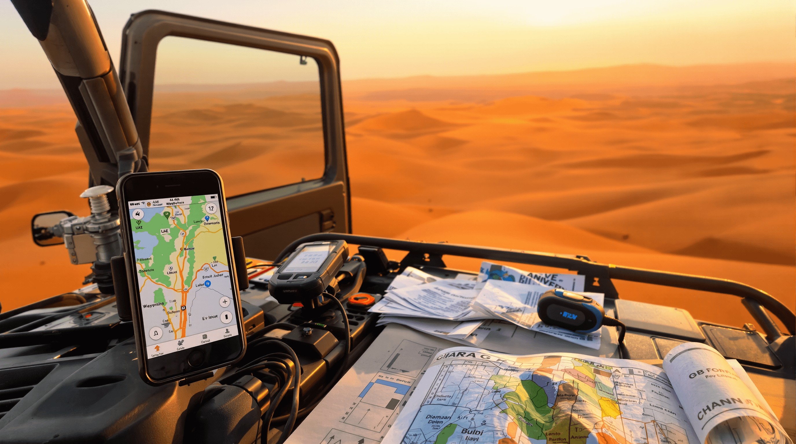
Gaia GPS is the one I reach for most. It has proper topographic layers and satellite imagery, you can download regions for offline use, drop waypoints for camp spots or where you aired down, and record a track so you can follow your own breadcrumbs back out. The track-recording habit alone has saved me more than once when the dunes all start looking the same. It's a paid subscription for the full layers, which is the main downside.
OsmAnd is a strong free option built on OpenStreetMap data. The offline maps are small, it handles waypoints and routing well, and a lot of desert tracks and wadis are actually mapped in OSM thanks to local contributors. The interface takes a bit of getting used to, but it does the job without a subscription.
Maps.me is the simplest of the three. Download the country once, search for a landmark, navigate offline. It's not as detailed as Gaia, but for a beginner who just wants something that works without a signal, it's an easy start.
If you like working from proper survey-style maps, Avenza Maps lets you load georeferenced PDFs and see your position on them offline. It's more niche, but useful if you've got a specific map you want to follow.
Whatever you pick, the important part is the same: download the area you're going to before you have no signal, and test that it actually loads in airplane mode before you rely on it in the field.
Do you need a dedicated GPS unit?
For most weekend drivers, a phone with downloaded maps is enough. Phones do struggle in the heat though - leave one on the dash in summer and it'll throttle or shut down, and GPS use chews through battery. So if you're going to lean on a phone, keep it cool, keep it charged, and bring a power bank.
If you do a lot of remote driving, a handheld GPS like a Garmin eTrex is worth considering. They run on AA batteries, handle heat far better than a phone, and won't die because you took one too many photos. The bigger reason to look at a dedicated device is satellite messaging - units like the Garmin inReach line let you send an SOS or a check-in message with your coordinates from places with zero cellular coverage. That's a genuine safety feature for the deep stuff out near the Empty Quarter, not a gimmick.
You don't need any of this for a Sunday run at Al Qudra. You start wanting it when you're going somewhere you couldn't easily walk out of.
Map accuracy isn't uniform
Coverage and detail are good around Dubai, Sharjah and the populated areas - the tracks people drive regularly tend to be well mapped. The further out you go, particularly toward Liwa and the western desert near the Saudi border, the older and patchier the data gets. Satellite imagery can be a couple of years stale, and a track shown on the map might be drifted over, fenced off, or gone entirely.
The practical takeaway: don't treat any single map as gospel out there. Cross-check, and trust what's in front of your eyes over what's on the screen. A map is a planning tool, not a guarantee.
Habits that matter more than the app
The gear is only half of it. These are the things that actually keep you found:
- Record your track on the way in. Following your own line back out is the single most reliable recovery tool you have when nothing looks familiar.
- Mark waypoints as you go - where you turned off the road, camp, anything you'll want to return to.
- Carry a backup. A second phone, or a handheld unit, with the same maps and waypoints loaded. Phones die at the worst times.
- Keep your devices charged and cool. A power bank lives in my bag year-round; in summer it's not optional.
- Don't drive solo into remote desert. A second vehicle is worth more than any app if you're stuck or broken down.
If you want to build these habits properly, a desert driving course will teach you navigation alongside the recovery and driving skills - it's a better starting point than figuring it all out the hard way. For longer self-supported trips, the overlanding guide goes deeper on planning and kit.
A few common questions
Do offline maps work with no signal at all? Yes. Once the maps are downloaded to your device, your GPS gets its position from satellites, which don't need cellular at all. You just need a connection beforehand to download the maps.
Can I share my location in an emergency from offline maps? The app can show your coordinates offline, but sending them to someone needs either a cellular signal or a satellite messenger. If you're going somewhere genuinely remote, a satellite communicator is the answer.
How often should I update my downloaded maps? Refresh them before any big trip, especially heading somewhere new. Tracks and the land around development and oil-field areas change, and stale data is most likely to bite you in the remote west.
Reviewed by experienced desert drivers. Our team personally visits operators and tests courses across the UAE.
Explore the Directory
Find off-road clubs, courses, garages and events across Dubai & UAE.
View Directory →